

For the first time in a long time we were lucky enough to get away for a few days and spent last week at my parent's beach house in St Leonards, which is on the Bellarine Peninsula along Australia's south-eastern coast.
I'd been looking forward to heading down there for ages. Yeah, sure, for the salty scent in the air, barefoot walks on the sand, laid-back evening BBQ's and the general un-necessity for usual household chores though also because I wanted to finally finish off their living room coffee table so I could blog about it :-)
I picked up this beast of a thing on eBay for just $10.

I got it so cheap cause the glass top was severely scratched, which to most people is probably a major deterrent, though to me (and I'm sure many other crafty bloggers out there) was an excuse to get creative!
If you're not new here you may be familiar with this cabinet...

...and this map...

...which both express some of the love I hold for cartography and both helped influence the direction I took to transform my parent's coffee table.
To give the table extra interest and a personal touch, we (that's Mum and I) decided on a map which incorporated the town their beach house is in. So, I searched the internet and eventually found an awesome zoomable historic yatching and excursions map of Port Phillip Bay circa 1885 - how cool!
If you're looking for a map of your own area try searching the image files in on-line National Library collections.

So, using the same process I used to create my large map of Paris (as outlined in this post) I re-worked the map of Port Phillip Bay to fit the existing glass table top. This process can take some time (fiddling with size, colour, cropping, etc) until it's just right. I then took it to my local printer and had it printed on medium weight paper. It cost around $35 (for full colour and over one meter square in size - not too bad).

(The map had to be printed in two parts because it was too large for one sheet of paper).
Then, using the same process I used to affix the wrapping paper to the top of my nautical cabinet (as outlined here) I attached the map of Port Phillip Bay to the coffee table glass.

Dad repainted the timber base white which gives it a fresh, coastal feel though I think it would look great to colour match it with one of the muted sea-greens or sepia tones in the map too. I lightly distressed the edges with a sanding block.

The top has had about eight coats of sealer so is really well protected and can be wiped clean with a damp cloth just like any surface.

The digital map I used is scanned from an original so shows signs of wear, such as fold lines and tears which I personally really love.
And look, here's St Leonards (on the Bay) - the town my parent's beach house is in!
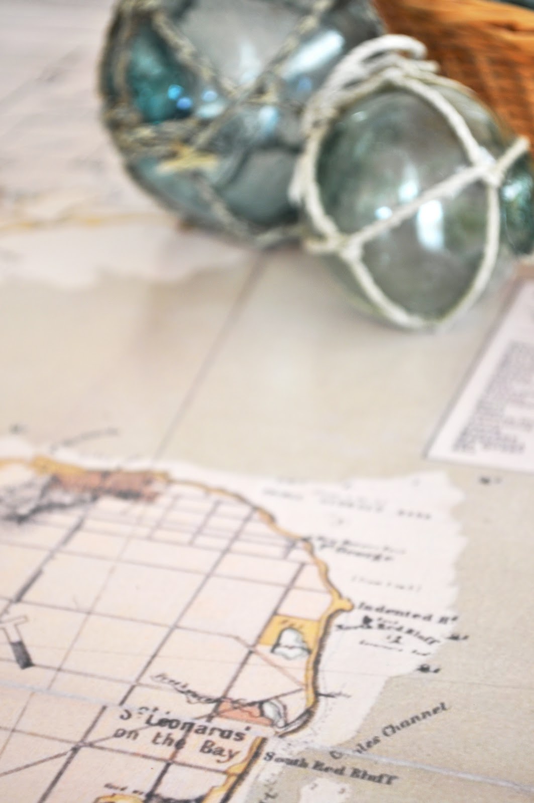
It's really wonderful to have this map, not only for its aesthetic appeal, though also for its connection of place which makes it extra interesting and somewhat special.

Linking this project with some of these parties.

Oh, and for those who have asked, little Miss Charlotte is doing really well. Three months old now and more cute (and chubby) every day.
Her nursery should be ready for the reveal in early October!
إرسال تعليق